Parish Townlands
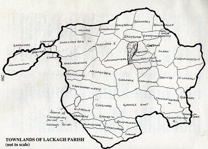
For detailed townland boundaries see www.openstreetmap.org
http://places.webworld.org/place/ has detailed information on each parish townland. Click on the townland name below to bring up information about that townland.
Townlands of Lackagh Parish
Ballinvoher (Baile an Bhóthair)-Town or village of the road.
Ballybrone (Baile an Bhrunaigh)-Valley of Sorrow or the town of the Querns or Millstones. The old name was Ballybrown.
Ballyglass (Baile Ghlais)-The green valley or the green village.
Ballymoneen (Baile Mhóinín)- Town or village of the little bog.
Ballynasheeoge (Baile na Siodhóg)-Town of the fairies or fairy village.
Barnaboy (Bearna Buí)- Yellow Gap.
Baunmore (An Bán Mór)- Big green field.
Cahertymore (Cathair na tighe Mhóir)- Village of the big house.
Cahernahoon (Cathair na hUamhan)- Village of the cave.
Cahernashilleeny (Cathair na Silanidhe)- Cherry Fort or place of the trickles of water.
Canteeny (Caintinidhe)- Small division of land.
Carheenlea (Cairthín Liath)- A grey little fort.
Carheeny (Cairthínidhe)- A little stone fort.
Crusheeny (Croisíní)- Little crosses.
Caraun (Carán)- Often designates a round abrupt little hill, generally rocky.
Caraunkeelwy (Caran Caol Mhaighe)- A round rocky hill. Round hill of the narrow plain.
Cashla (Caisle)- Stone fort.
Cloghan (Clochán)- Can be a row of stepping stones through a bog or a village of about twelve small houses.
Cloonavadogue (Cluain na bhFeadóg)- Meadow of the plovers.
Coolarne (Cúl Áirne)- Cúl Árainn-Back of the high ridge, wood of sloe bushes.
Cregcarragh (Creag Carrach)- Rugged rock.
Cregmore (Creag Mór)- The big stone, great rock.
Derrymacloughna (Doire Mhic Lachtna)- Oak wood of the son of Lachtna.
Garraun (Garrán)- Small wood or grove.
Garrymore /Gardenham-(Garraidh Mór )- great garden or tilled field
Glenmore (Gleann Mór)- A big glen.
Grange (Gráinseach)- Grange or Monastic Farm
Island (Oileán)- Piece of land surrounded by water.
Kilskeagh (Coill Sceach)- Wood of the sceachs or whitethorn bushes.
Kiltrogue (Cill Trog)- Chill-Church of St. Trog.
Knockdoe (Cnoc Tua)= The hill of the axes. (Cnoc Tuath)=The hill of the Clans
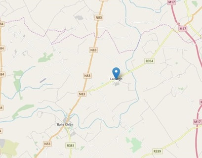
Lackagh (Leacach)- A hillside flaggy, full of flat stones
Liscannanaun (Lios Ceann an Átha, Lios Ceannanainn)- Ancient fort.
Lisheenavalla (Lisín a'Bhealaigh)- Little fort of the pass or road.
Mirah (Máigh Réidh)- Level land or plain.
Monard (Móin Árd)- High turf or moss
Monroe (Móin Ruadh)- Red turf or moss
Parkgarve (Páirc Garbh)-Rough park or field.
Rathfee (Ráthfaoi)- The heathery rath or fort.
Sheeaun Park (Cnoc an tSídheáin)- Fairy field.
Turloughmore (Turloch Mór)- The lake which dries up in Summer.
1661 ForfeituresTaken in the years 1656-1658, the Down Survey of Ireland sought to measure all the land to be forfeited by the Catholic Irish in order to facilitate its redistribution to Merchant Adventurers and English soldiers loyal to Cromwell.
TCD now hosts an interactive map with details of the 1641 townland owner and the 1670 owner. |
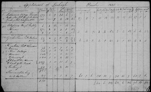
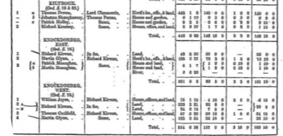
Tithe ApplotmentsTithes were taxes imposed on all landholders, regardless of their denomination, to support the Church of Ireland clergy.
In 1838, the government passed an act which converted tithes into a fixed rent-charge and responsibility for payment was transferred from tenant to landlord. |
|
